
There are both paved and natural-surface (dirt) trails within Taylor Creek Park, Toronto, On that you can run on. In part one I will discuss the multitude of sights you will encounter as you run on the paved paths throughout the park and in part two I will explore the dirt paths.
Taylor Creek Trail is one of my favourite trails to
run in the Toronto’s east end, probably partly due to the fact it’s practically
in my backyard. It’s a 3.5 kilometre point-to-point paved trail that begins at
Dawes Road and ends at Don Mills Road. Since it’s a flat trail, it’s not very
challenging, but it’s a good opportunity to get in some fartlek’s or some hill
repeats by climbing the numerous stairs out of the valley. It’s also a nice
chance to get close to nature and not have to worry about battling cars and
street lights. It’s a multi-use trail though so cyclists and pedestrians also
use this path.

Taylor Creek is one of the most significant
tributaries of The Don River and is named after the Taylor family who had a
huge share in the early paper industry in Toronto. They eventually owned three
paper mills with one of them being at the Forks of the Don. The
Taylors also owned and operated the Don Valley Brick Works.

When you first enter the park off of Dawes Street
there is a parking lot with a public washroom which is closed at the moment due
to Covid19. The trail entrance is just past the parking lot with the creek on
the right. As you run you are rewarded with lovely views along the way.
Unfortunately, you are also inundated with a horrible smell since the water has
been long abused, mostly by pollution and sewage waste. However, there is an
ambitious plan underway to virtually free the creek (and the entire ravine
system) of sewage and storm water which could improve the water quality to the
point that the creek would be safe for swimming. It will cost between $4 and $5
billion and will be completed sometime in the 2030’s.

Just past the entrance, in the open field there is a
newly built bat house. There is another one in the park just after the fire
circle and there are numerous houses being built throughout Ontario to save
endangered bats. White-nose syndrome, a
fungal infection that affects bats, has killed millions of the animals in North
America in the last decade, as well as pesticides. The bats will be tracked,
paying close attention to several at-risk species. Although many people have a fear of bats, they have many benefits to the environment.
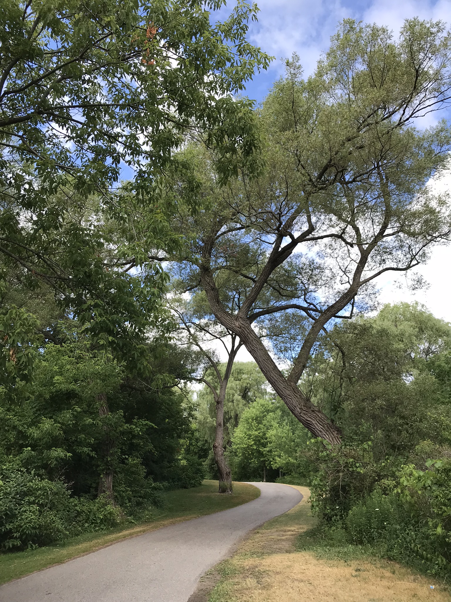
As you run through the trail, you will see many beautiful big trees.

There are many animals to discover along the trail. I have come across white-tailed deer several times as well as raccoons, squirrels, chipmunks, rabbits, garter snakes, turtles, heron, and a coyote (which I admit kind of freaked me out). There are also foxes, and skunks.


There are many native and invasive plants throughout
this park. Some native plants are goldenrod, narrow-leaved cattail, red oak,
riverbank grape, and New England Aster. Some invasive plants are Japanese
Sweet-Coltsfoot, European Buckhorn, Phragmites, and Dog-Strangling Vine. Although
poisonous, Cow parsnip is a common native plant species. Cow-parsnip contains
chemicals that may cause severe skin inflammation known as dermatitis. Ultraviolet
rays from the sun activate the sap from the plant and may cause the skin to
redden and even produce permanent discoloration.
There are also wild raspberry and blackberry bushes
and in the spring/summer you can see people bring baskets to pick them.

At about kilometre 1.5 you will come to a fork in the
path. The trail going left will take you to Haldon Ave.


Further up there is a picnic circle on your left. In
order to use this fire pit, you have to secure a permit from the city. There is
another one located at around the 3 kilometre mark. It is used frequently
during the school year by a forest school and you can see all the wee ones running
about playing in the mud, exploring their surroundings and having a great time
while doing so.

The path crosses under the Woodbine Bridge which was
built in 1932 and is one of Toronto’s largest bridges measuring at eight
hundred and ten feet long and forty-six feet wide. It cost two hundred and
seventy five thousand dollars to build it. It has a highly ornate design with a
single, large arch main span and a series of t-beam approach spans.

At kilometre 2 you will come across the second marsh
on the trail. You won’t be able to see it from the path, but will have to walk
up a small dirt path on the left to get to it. Like the other marsh, there are
frogs and cattails and various birds. However, this one also has lily pads and
some sort of algae growing in it. It looks like someone sprayed brown shaving
cream onto the surface of the water.

Just after leaving the pond, the path splits. Take the
wooden bridge as the lower bridge is always flooded out.


Here the path splits for the second time. Take the
wooden bridge on the right as the other path tends to be slippery even when
it’s not flooded. This bridge passes over Curity Creek, a small tributary of
Taylor Creek. Taylor Creek is on the left.

Marsh number three has frogs, lily pads, garter snakes
and dragonflies. This wetland was excavated in one of the cattail fens in 2011.
Most of the original ponds and wetlands were filled in in the 1980’s, to
control mosquitoes and prevent flooding of picnic areas and the paved walking
path. Fortunately, the city parks now follows a policy of naturalization - a
combination of habitat restoration and benign neglect - and the wetlands are
back.

At
kilometre 2.5 you will come across 2 benches that were painted as part of the
celebrations for the July 2015 Pan Am games that took place in Toronto. Artists Anjuli
Solanki and Carlos Delgado collaborated on this series and they were inspired
by textile patterns from Caribbean, North, South, and Central American
cultures, as well as the South Asian communities that reside in neighbouring
Thorncliffe Park. The design of these benches celebrate the storytelling,
history, science, math, and art that intersects in textiles from across the
globe.
On the right is the Alder stairs which leads to
Gatineau Corridor Trail.

Just past the bridge crossing to the south side of the
creek, there is a small building with a solar panel on its roof. The building
is one of 14 automated monitoring stations installed along Toronto watercourses
by the Toronto and Region Conservation Authority (TRCA) and the City of Toronto
which monitors water conditions during storm events and in dry weather to help
evaluate the city’s Wet Weather Flow Management Master Plan and the overall
health of the city’s surface water. This station has been designed to operate
remotely using wireless technology and is capable of functioning 365 days a
year. Water quality parameters, including nutrients, metals, bacteria and
general chemistry, are analyzed monthly.

The path splits for the 3rd time. Again, take the right path. Both tend to flood, but the left is completely submerged under water.

On the left, cross the wooden bridge over Taylor Creek.

View of creek while on the bridge. The water is really
low at the moment due to a really hot summer with very little rain.

There is an off-leash dog park that isn’t being used
at the moment due to covid19. It wasn’t the best planned space since there are
no trees around and the dogs are in the direct hot sunlight.

The path leads under the Don Valley parkway.

The trail ends at the Forks of the Don where you will
see giant molars protruding out the earth. Of course they aren’t really teeth,
but “elevated wetlands”—6 polystyrene containers filled with recycled plastics
acting as hydroponics planters of native plants from the Don River Valley.
Water is pumped from the Don River via solar photovoltaic pumps into the
sculpture and filtered through the containers, then cascades into the large
ground level wetlands, returning to the River much cleaner than it started out.
The work draws attention to the importance of wetland
ecosystems, and more importantly the rate at which they are disappearing.

Taylor Creek trail connects with two other trails. The first option is to go across the concrete bowstring bridge to the Charles Sauriol Conservation and then follow the trail north through E.T Seton Park, Wilket Creek Park, Serena Grundy Park and then Sunnybrook Park.

While the trail is great to run in the spring, summer
and fall, it's not maintained during the winter months which makes it difficult
to run on due to all the snow and ice. People do, however snowshoe and cross
country ski.


thank you so much for posting this! I was looking for a trail to explore and stumbled across this.
ReplyDeleteYou're welcome! You'll have to let me know how it went!
Delete